

Migration Maps
We here at the World of Hummingbirds .com worked with Google Earth and Google Maps to create a mapping system of the migration of hummingbirds around the world. This will allow everyone to see when hummingbirds are migrating and where and can make their plans accordingly.
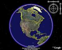
The best way to view these maps is by using Google Earth. This is a free download and a terrific tool for just about any mapping application you can think of. If you have a computer that does not run Google Earth, not a problem, you can also utilize Google Maps.
Maps
| Map | Google Maps | Google Earth |
|---|---|---|
|
2012 Fall Migration Maps |
View Larger Map |
|
|
2012 Spring Migration Maps |
View Larger Map |
|
|
2011 Fall Migration Maps |
View Larger Map |
|
|
2011 Spring Migration Maps |
View Larger Map |
|
|
2010 Fall Migration Maps |
View Larger Map |
|
|
2010 Spring Migration Maps |
View Larger Map |
|
|
2009 Fall Migration Maps |
View Larger Map |
|
|
2009 Spring Migration Maps |
View Larger Map |
|
|
2008 Fall Migration Maps |
View Larger Map |
|
|
2008 Spring Migration Maps |
View Larger Map |
|
|
Note: If your computer has an issue opening these files, right click on the icon and choose the Save File As option. Save the file to your desktop. Then open Google Earth and open the file from there.
|
||
How to Read the Migration Maps
Each of the different icons represents different calendar weeks of the migration season.
Contribute to the Migration Maps
You too can contribute to these Migration Maps by clicking here or using the link on the left menu.
Migration Map Notification
Want to see when your information has been updated? If so, sign up in our notification system and get updates and notifications as they occur.
